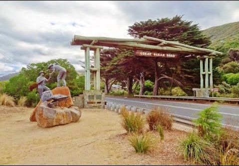
The Great Ocean Road is an Australian National Heritage listed 243 kilometres (151 mi) stretch of road along the south-eastern coast of Australia between the Victorian cities of Torquay and Allansford. Built by returned soldiers between 1919 and 1932 and dedicated to soldiers killed during World War I, the road is the world's largest war memorial. Winding through varying terrain along the coast and providing access to several prominent landmarks, including the Twelve Apostles limestone stack formations, the road is an important tourist attraction in the region.
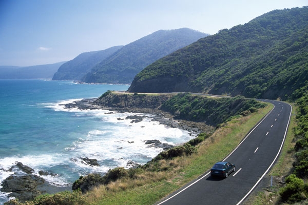
The Great Ocean Road starts at Torquay and travels 244 kilometres westward to finish at Allansford near Warrnambool, the largest city along the road. The road is two lane (one in each direction), and is covered by a speed limit changing between 60 kilometres per hour and 100 kilometres per hour
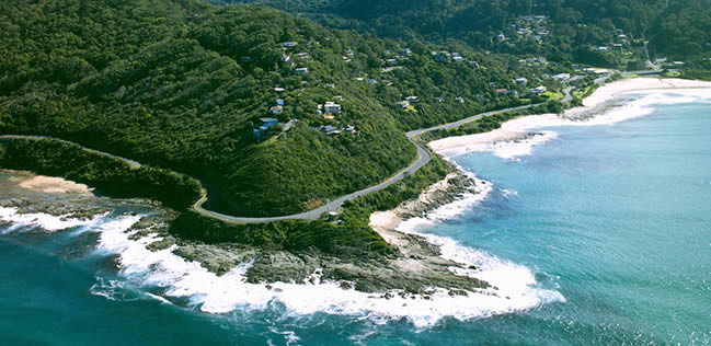
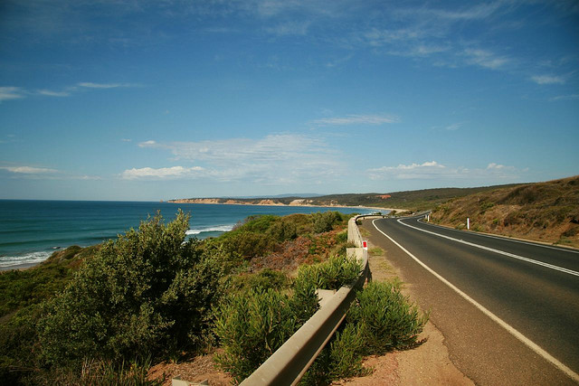
The road is considered a tourist attraction in the area, in which much of the road hugs coastline affectionately known as the Surf Coast between Torquay and Cape Otway and the Shipwreck Coast further west of Cape Otway, providing visibility of Bass Strait and the Southern Ocean. The road traverses rainforests, as well as beaches and cliffs composed of limestone and sandstone, which is susceptible to erosion. The road travels via Anglesea, Lorne, Apollo Bay, and Port Campbell, the latter being notable for its natural limestone and sandstone rock formations including Loch Ard Gorge, The Grotto, London Arch (formerly London Bridge) and The Twelve Apostles. At the stretch of the Great Ocean Road nearer to Geelong, the road meanders along the coast, with tall, almost-vertical cliffs on the other side of it. Road signs put up along the road warn motorists of possible rockfalls, which have occurred before.
The city of Geelong, close to Torquay, experiences great benefit from Australian and international visitors to the road; with Geelong Otway Tourism affirming it as an invaluable asset. The Royal Automobile Club of Victoria (RACV) listed the road as the state's top tourism experience in its Victoria 101 survey, based on spots recommended by members and the public on what they would recommend to visitors. However, according to a survey performed by the Surf Coast Shire, residents have expressed concern that there are not enough safe crossings along the road.
The Great Ocean Road was first planned towards the end of the first world war, when chairman of the Country Roads Board, William Calder, asked the State War Council for funds to be provided for returned soldiers to work on roads in sparsely populated areas in the Western District. By the time of World War I, the rugged south-west coast of Victoria was accessible only by sea or rough bush track. Besides being dedicated as a memorial, it was also envisaged that the road would connect isolated settlements on the coast, and become a vital transport link for the timber industry and tourism.
Surveying for the road, tentatively titled the South Coast Road, started in 1918 – with the road suggested to travel from Barwon Heads, follow the coast west around Cape Otway, and end near Warrnambool. In 1918, the Great Ocean Road Trust was formed as a private company, under the helm of president Howard Hitchcock. The company managed to secure £81,000 in capital from private subscription and borrowing, with Hitchcock himself contributing £3000. Money would be repaid by charging drivers a toll until the debt was cleared, and the road would then be gifted to the state.
In 1962, the road was deemed by the Tourist Development Authority to be one of the world's great scenic roads. It also had sections widened between the Lorne Hotel and the Pacific Hotel to improve traffic, while aiming to preserve its character. Despite improvements, the road was still considered a challenging drive; the Victorian Police motor school even using it for training around 1966.
Over its life, the Great Ocean Road has been susceptible to natural elements; in 1960 the section at Princetown was partially washed away by water during storms. It experienced landslides on 11 August 1964, and in 1971; both closing sections of the road near Lorne. Because of the terrain surrounding the road, it was also closed due to bush-fires in 1962 and 1964; particularly in areas with nearby camp-sites. In January 2011 a section of the overhanging cliffs collapsed due to heavy rain.
In 2011, the road was added to the Australian National Heritage List.