The Medina of Tunis is the Medina quarter of Tunis, capital of Tunisia. It has been a UNESCO World Heritage Site since 1979.
The Medina contains some 700 monuments, including palaces, mosques, mausoleums, madrasas and fountains dating from the Almohad and the Hafsid periods.
History
Founded in 698 around the original core of the Zitouna Mosque, the Medina of Tunis developed its urban fabric throughout the Middle Ages. The main axis was between the mosque and the centre of government to the west in the kasbah. To the east this same main road extended to the Bab el Bhar. Expansions to the north and south divided the main Medina into two suburbs north (Bab Souika) and south (Bab El Jazira).
Before the Almohad Caliphate, other cities such as Mahdia and Kairouan had served as capitals. Under Almohad rule, Tunis became the capital of Ifriqiya, and under the Hafsid period it developed into a religious, intellectual and economic center. It was during the Hafsid period that the Medina as we now know it took on its essential form. It gradually acquired a number of buildings and monuments combining the styles of Ifriqiya, Andalusian and Oriental influences, but also borrowing some of the columns and capitals of Roman and Byzantine monuments.
Social and urban structure
Street network of the Tunis medina
With an area of 270 hectares (plus 29 hectares for the district of the kasbah) and over 100,000 inhabitants (109,725 1984), the Medina has one-tenth of the population of Tunis and a sixth of the urbanized area of the agglomeration.
The complex organization of the urban fabric fueled an entire colonial literature of the dangerous Medina, anarchic and chaotic, and the territory of ambush. However since the 1930s, with the arrival of the first ethnologists, studies have revealed that the articulation of the Medina areas is not random, and houses are built according to clear sociocultural norms, codified according to complex types of human relationships. Many publications have detailed the development of the Medina model and system of prioritization of public and private spaces, residential and commercial, sacred and profane.
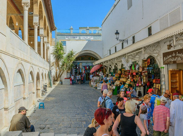
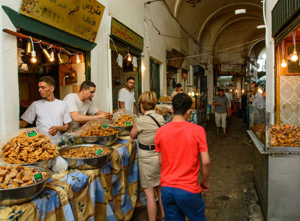
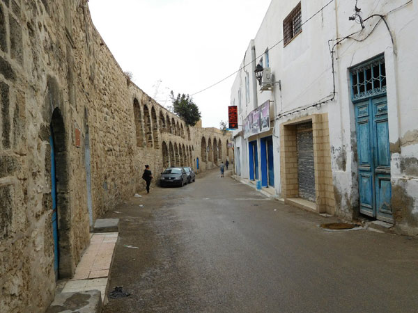
The urban layout of the Medina of Tunis has the distinction of not obeying geometrical layouts or formal compositions such as gridlines. Nevertheless the north-south and east-west axes are comparable to a Roman cardo and decumanus (Sidi Ben Arous, Jemaa Zitouna and Pasha Streets) that intersect at the court of Zitouna mosque, house of prayer and studies. The thoroughfares include the main streets; secondary streets and finally, small cul-de-sacs. Sometimes entire private spots are reserved for women. The built environment is generally characterized by the juxtaposition of large plots (600 m2) and joint ownership.
The concept of public space is ambiguous in the Medina where the streets are considered as the extension of houses and subject to social tags. The notion of individual ownership is low and displays in the souks often spill out onto the highway. This idea is reinforced by the area of a shop (about 3 m2) and bedroom (10 m2).