Saxon Switzerland National Park (German: Nationalpark Sächsische Schweiz), is a National Park in the German Free State of Saxony near the capital city of Dresden. It covers two areas of 93.5 km² (36.1 mi²) in the heart of the German part of the Elbe Sandstone Mountains which is called the Saxon Switzerland (German: Sächsische Schweiz).
The National Park adjoins Bohemian Switzerland National Park (Czech: České Švýcarsko) in the Czech Republic.
Landscape
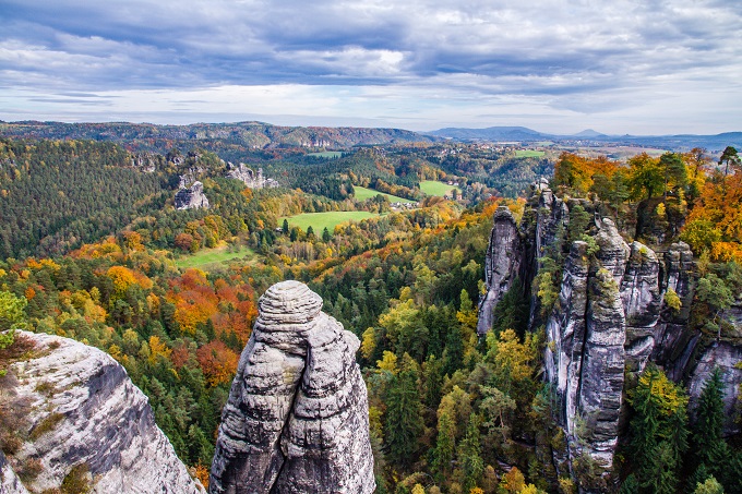
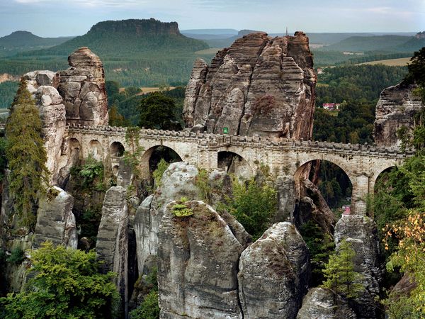
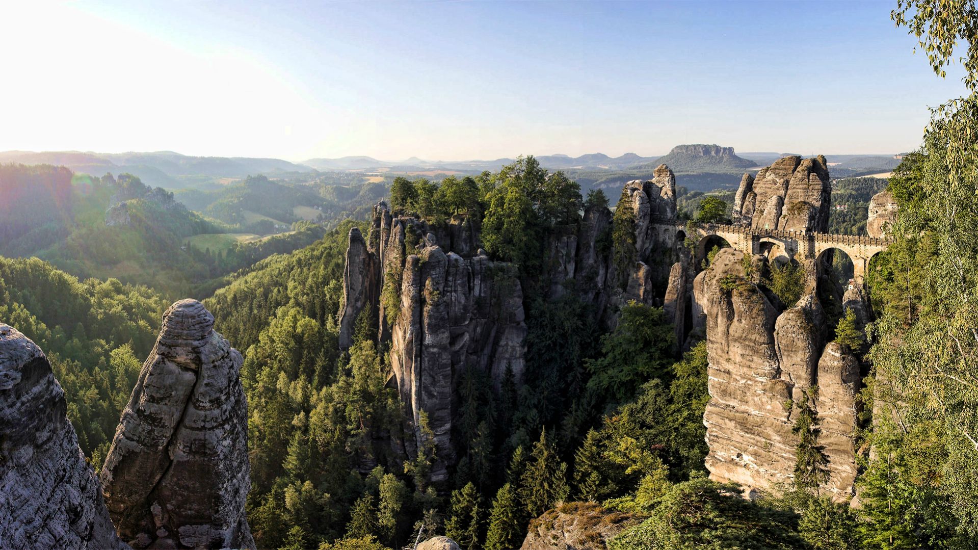
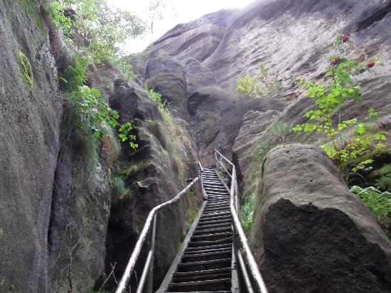
Saxon Switzerland is an intensively fissured and rocky canyon landscape. The highest peak of the National Park is at 556 metres (1,814 feet) above sea level but only in short distance to the valley of the Elbe river at 110 to 120 metres (360 to 390 feet). It offers several different habitats and microclimate zones due to its strong vertical division. The National Park still hosts some forms of forest without human intervention, which is an exception in central Europe. The special forms of mountain forest and gorge forest are endangered in Europe generally. Because of the saboulus soil and the fissures many places in that area are dryer than normally in the temperate zone and offers rough conditions. This makes this area so special.
Western region
This region includes the Bastei area, the Lilienstein and the Polenz valley. In the west it is bordered by Wehlen and Lohmen, in the north by Lohmen and Hohnstein, in the east by Hohnstein and Goßdorf and in the south by Porschdorf, Rathen and Wehlen. The municipality of Waitzdorf lies entirely within the western region. Important peaks are the Lilienstein (415 m), the Bastei (305 m), the Hockstein and the Brand (317 m). The Grünbach and the associated lake of Amselsee and the Polenz are the only waterbodies of note.
Eastern region
The eastern region includes the area of the Schrammsteine rocks, the Großer Winterberg mountain, the Großer Zschand valley and the hinterland of Saxon Switzerland (Hinterer Sächsischen Schweiz). To the west it is bordered by Bad Schandau and Altendorf and to the north by Altendorf, Ottendorf and Hinterhermsdorf. To the east and south it is bordered by the Bohemian Switzerland National Park. From Schmilka to Bad Schandau the Elbe forms the southern boundary of this region. Important peaks are the Großer Winterberg (556 m), the Kuhstall (337 m) and the Raumberg (459 m). The Kirnitzsch is the only waterbody of note.
Tourism and recreation
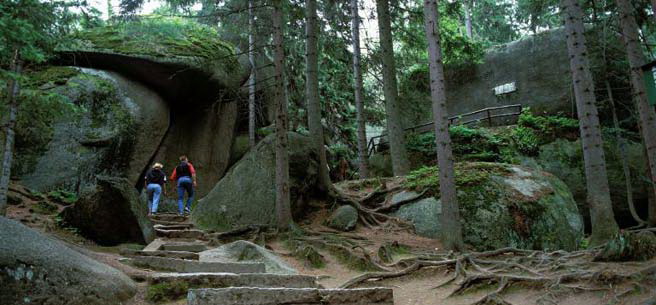
The National Parks is, in some cases, in conflict with tourism and recreation. One objective is to raise the inviolate area to 75%, which means limiting the areas of hiking and climbing. Today there are some 400 km (250 mi) of hiking paths, 49.9 km (31.0 mi) of biking paths, and 755 climbing locations with around 12,600 possibilities of climbing routes. The National Park is part of a larger region that serves as a recreation area close to Dresden. Bad Schandau has a station in the EuroCity network and is some 45 minutes away from Dresden (by Dresden S-Bahn).
Information posts
National Park Headquarters
National Park Centre in Bad Schandau
National Park Office in Bad Schandau
Information posts
Schweizerhaus on the Bastei
Amselfall mountain hut
Log cabin on the Brand
Eishaus on the Großer Winterberg
Armoury in the Großer Zschand
Haus Beize and Waldhusche in Hinterhermsdorf