Arran or the Isle of Arran (/ˈærən/; Scottish Gaelic: Eilean Arainn pronounced [elan ˈarɪɲ]) is the largest island in the Firth of Clyde, Scotland. With an area of 432 square kilometres (167 sq mi) it is the seventh largest Scottish island. It is in the unitary council area of North Ayrshire. In the 2011 census it had a resident population of 4,629. Although it is culturally and physically similar to the Hebrides, it is separated from them by the Kintyre peninsula. Arran is divided into highland and lowland areas by the Highland Boundary Fault and it has been described as a "geologist's paradise".
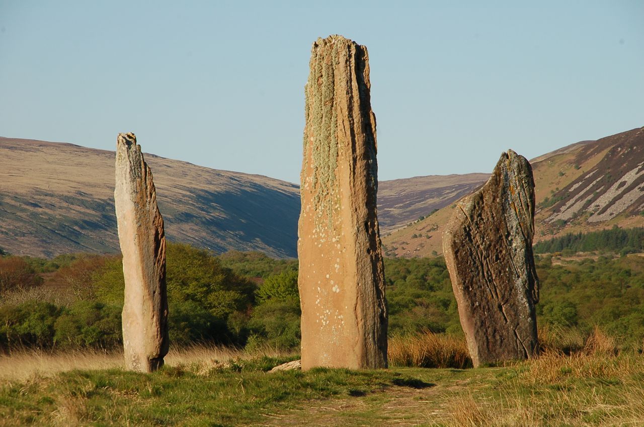
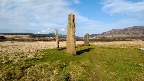
Arran has been continuously inhabited since the early Neolithic period, and numerous prehistoric remains have been found. From the 6th century onwards, Goidelic-speaking peoples from Ireland colonised the island and it became a centre of religious activity. During the troubled Viking Age, Arran became the property of the Norwegian crown before becoming formally absorbed by the kingdom of Scotland in the 13th century. The 19th century "clearances" led to significant depopulation and the end of the Gaelic language and way of life.
The economy and population have recovered in recent years, the main industry being tourism. There is diversity of wildlife, including three species of tree endemic to the area.
Most of the islands of Scotland have been occupied by the speakers of at least four languages since the Iron Age, and many of the names of these islands have more than one possible meaning as a result. Arran is therefore not unusual in that the derivation of the name is far from clear. Mac an Tàilleir (2003) states that "it is said to be unrelated to the name Aran in Ireland" (which means "kidney shaped", cf Irish ára "kidney"). Unusually for a Scottish island, Haswell-Smith (2004) offers a Brythonic derivation and a meaning of "high place" which at least corresponds with the geography—Arran is significantly loftier than all the land that immediately surrounds it along the shores of the Firth of Clyde.
Any other Brythonic place names that may have existed were later replaced on Arran as the Goidelic-speaking Gaels spread from Ireland via their adjacent kingdom of Dál Riata. During the Viking Age the island, along with the vast majority of the Scottish islands, became the property of the Norwegian crown, at which time it may have been known as "Herrey" or "Hersey". As a result of this Norse influence, many current place names on Arran are of Viking origin.
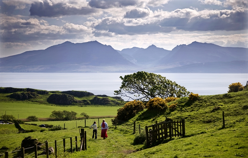
The island lies in the Firth of Clyde between Ayr and Ardrossan, and Kintyre. The profile of the north Arran hills as seen from the Ayrshire coast is a well-known sight referred to as the "Sleeping Warrior" due to its resemblance to a resting human figure. The highest of these hills is Goat Fell at 873.5 metres (2,866 ft). There are three other Corbetts, all in the north east: Caisteal Abhail, Cìr Mhòr and Beinn Tarsuinn. Beinn Bharrain is the highest peak in the north west at 721 metres (2,365 ft).
The largest valley on the island is Glen Iorsa to the west, whilst narrow Glen Sannox (Gaelic: Gleann Shannaig) and Glen Rosa (Gaelic: Gleann Ròsa) to the east surround Goat Fell. The terrain to the south is less mountainous, although a considerable portion of the interior lies above 350 metres (1,150 ft), and A' Chruach reaches 512 metres (1,680 ft) at its summit. There are two other Marilyns in the south, Tighvein and Beinn Bhreac.
Arran is sometimes referred to as "Scotland in miniature", as it is divided into "Highland" and "Lowland" areas by the Highland Boundary Fault which runs northeast to southwest across Scotland. Arran is a popular destination for geologists, who come to see intrusive igneous landforms such as sills and dykes as well as sedimentary and metasedimentary rocks ranging in age from Precambrian to Mesozoic.
Most of the interior of the northern half of the island is taken up by a large granite batholith that was created by substantial magmatic activity around 58 million years ago in the Paleogene period. This comprises an outer ring of coarse granite and an inner core of finer grained granite, which was intruded later. This granite was intruded into the Late Proterozoic to Cambrian metasediments of the Dalradian Supergroup. Other Paleogene igneous rocks on Arran include extensive felsic and composite sills in the south of the island, and the central ring complex, an eroded caldera system surrounded by a near-continuous ring of granitic rocks.
Sedimentary rocks dominate the southern half of the island, especially Old and New Red Sandstone. Some of these sandstones contain fulgurites - pitted marks that may have been created by Permian lightning strikes. Large aeolian sand dunes are preserved in Permian sandstones near Brodick, showing the presence of an ancient desert. Within the central complex are subsided blocks of Triassic sandstone and marl, Jurassic shale, and even a rare example of Cretaceous chalk. During the 19th century barytes was mined near Sannox. First discovered in 1840, nearly 5,000 tons were produced between 1853 and 1862. The mine was closed by the 11th Duke of Hamilton on the grounds that it "spoiled the solemn grandeur of the scene" but was reopened after the First World War and operated until 1938 when the vein ran out.
Visiting in 1787, the geologist James Hutton found his first example of an unconformity to the north of Newton Point near Lochranza, which provided evidence for his Plutonist theories of uniformitarianism and about the age of the Earth. This spot is one of the most famous places in the study of geology.
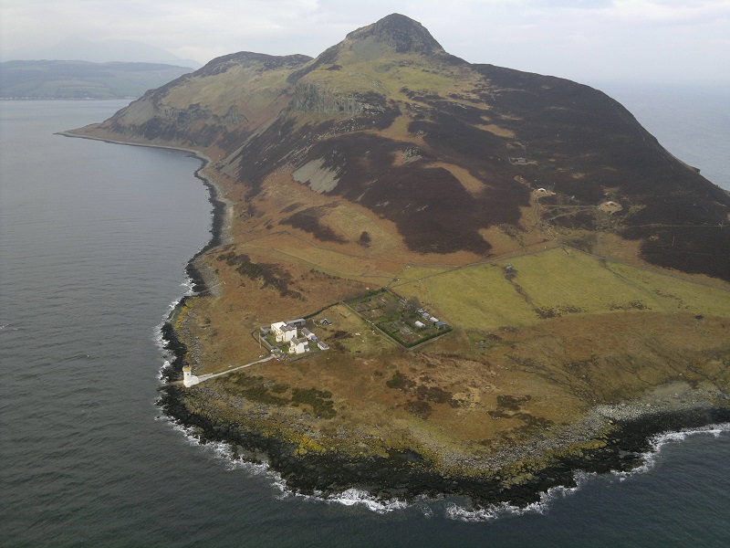
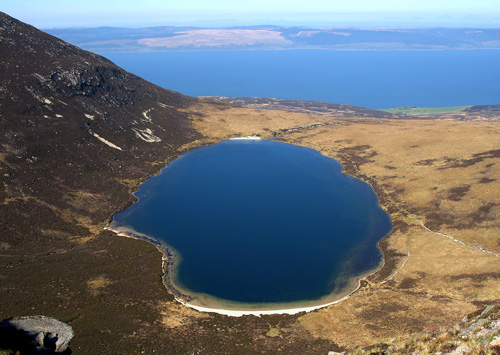
The Pleistocene glaciations almost entirely covered Scotland in ice, and Arran's highest peaks may have been nunataks at this time. After the last retreat of the ice at the close of the Pleistocene epoch sea levels were up to 70 metres (230 ft) lower than at present and it is likely that circa 14,000 BP the island was connected to mainland Scotland. Sea level changes and the isostatic rise of land makes charting post-glacial coastlines a complex task, but it is evident that the island is ringed by post glacial raised beaches. King's Cave on the south west coast is an example of an emergent landform on such a raised beach. This cave, which is over 30.5 metres (100 ft) long and up to 15.3 metres (50 ft) high, lies well above the present day sea level. There are tall sea cliffs to the north east including large rock slides under the heights of Torr Reamhar, Torr Meadhonach and at Scriden (An Scriodan) at the far north end of the island.
Natural history
The island has three endemic species of tree, the Arran whitebeams. These trees are the Scottish or Arran whitebeam (Sorbus arranensis), the bastard mountain ash or cut-leaved whitebeam (Sorbus pseudofennica) and the Catacol whitebeam (Sorbus pseudomeinichii). If rarity is measured by numbers alone they are amongst the most endangered tree species in the world. They are protected in Glen Diomhan off Glen Catacol, at the north end of the island by a partly fenced off national nature reserve, and are monitored by staff from Scottish Natural Heritage. Only 236 Sorbus pseudofennica and 283 Sorbus arranensis were recorded as mature trees in 1980. They are typically trees of the mountain slopes, close to the tree line. However, they will grow at lower altitudes, and are being preserved within Brodick Country Park.
Over 200 species of bird have been recorded on Arran including black guillemot, eider, peregrine falcon and the golden eagle. In 1981 there were 28 ptarmigan on Arran, but in 2009 it was reported that extensive surveys had been unable to record any. Similarly, the red-billed chough no longer breeds on the island.
Red deer are numerous on the northern hills, and there are populations of red squirrel, badger, otter, adder and common lizard. Offshore there are harbour porpoises, basking sharks and various species of dolphin.
The northern part of Lamlash Bay became a Marine Protected Area and a "no take zone" under the terms of the Marine (Scotland) Act 2010 which means that no fish or shellfish may be taken in the designated area. In 2014 the Scottish Government created Scotland's first Marine Conservation Order in order to protect delicate maerl beds off south Arran after fishermen breached a voluntary agreement not to trawl in the vicinity.